Petroleum Africa
Find us on: 


Monday, October 12, 2020
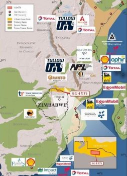
Invictus Energy has announced that the company is set to commence a field reconnaissance program in the next fortnight of field operations in the Cabora Bassa Project in Zimbabwe.
In an announcement, Invictus said that following the approval of the Environmental Management Plan, easing of COVID-19 related restrictions and the completion of the final cultural ceremonies in the Muzarabani and Mbire Districts, the company will commence field operations in the Cabora Bassa Basin.
The reconnaissance program and baseline survey consist of the traversing of the proposed infill seismic lines for a planned acquisition campaign in the 2021 dry season. The program will capture details such as topography, existing access roads, drainage, vegetation cover, soil types, rock exposures, sampling of any natural oil and gas seeps, areas of development (constructions and cultivation), plus any sites of cultural, religious or historic importance. The duration of the program is expected to be approx. 30 days and is in the final stages of planning and will be completed before the wet season.
The Cabora Bassa Project encompasses the Mzarabani Prospect, a multi-TCF and liquids rich conventional gas-condensate target, which is potentially the largest, undrilled seismically defined structure onshore Africa. The prospect is defined by a robust dataset acquired by Mobil in the early 1990s that includes seismic, gravity, aeromagnetic and geochemical data.
Managing Director Scott Macmillan commented: “We are extremely pleased to commence our activity on the ground in the Cabora Bassa Project having now received all of the necessary approvals and restrictions in the country being eased. The Company has a window of opportunity to carry out a reconnaissance program prior to the onset of the rainy season so that we can map out the routes for the planned seismic acquisition campaign next year. This exercise will enable us to map out the optimal route ahead of the survey which will reduce the acquisition time and maximize efficiency of the survey.”
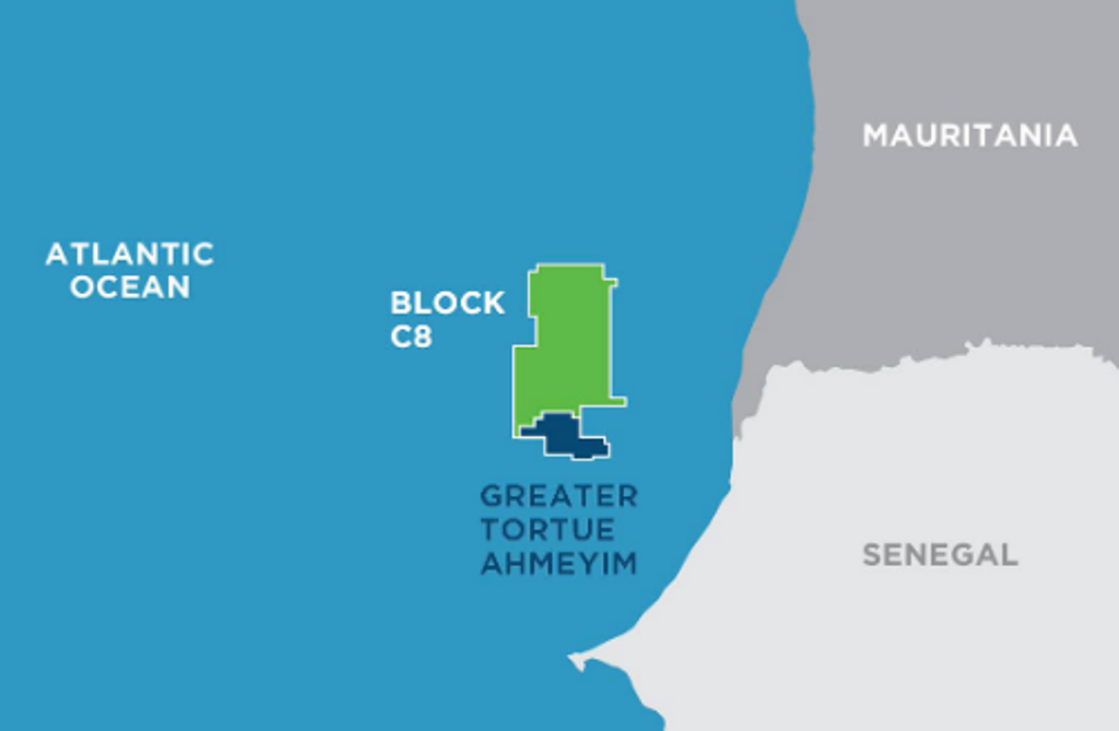 " alt="First LNG Realized at the Greater Tortue Ahmeyim Project">
 " alt="United Energy Acquires Western Desert Producer APEX">
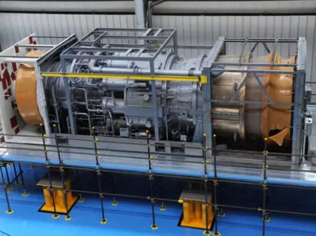 " alt="Baker Hughes Announces Major Gas Technology Orders for Venture Global LNG">
 " alt="Tullow Highlights 2025 Operational Plans in Ghana">
 " alt="TotalEnergies to Supply 1.5 TWh to STMicroelectronics in France Over 15 years">
 " alt="Oil & Gas Crucial for African Growth: AEC Calls for Industry Support to Defend African Market">
