Petroleum Africa
Find us on: 


Wednesday, August 17, 2022
Release PGS
New near-field exploration opportunities have been delineated in a recent case study using a GeoStreamer X dataset from the South Viking Graben. The results provide better and more accurate understanding of reservoirs and traps.
GeoStreamer X is an integrated broadband multi-azimuth acquisition and state-of-the-art depth imaging reservoir solution. It illuminates targets from multiple angles to deliver accurate reservoir parameters and trap geometries for volumetric estimates, and by providing reliable seismic attributes, can serve as a baseline for production monitoring.
Reservoir Property Estimation Using the MAZ Dataset
Following a very successful 2019 GeoStreamer X survey in the South Viking Graben, Norway, an additional multi-azimuth survey was acquired further north covering the Utsira High and the Vana Sub-basin.
A combination of innovative acquisition, imaging, quantitative interpretation, and seismic morphology interpretation highlights the underexplored Vana Sub-basin and near-field opportunities on the Utsira High. The data provide an enhanced understanding of the main prospective stratigraphic intervals (Tertiary–Jurassic) and allow improved quantitative assessment of exploration targets.
An Integrated Solution for High Fidelity Subsurface Understanding
The case study, publication in GeoExpro, and the webinar demonstrate that new opportunities can be found and characterized in a mature area such as the Norwegian South Viking Graben with a combination of innovative acquisition, and a seismic-driven reservoir property estimation. Structural and seismic morphology interpretation based on enhanced multi-azimuth imaging and combined with reliable seismic attributes provide a detailed understanding of the Jurassic target interval. The integrated workflow provides a powerful risking and uncertainty assessment tool for prospect assessment.
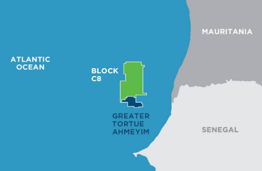 " alt="First LNG Realized at the Greater Tortue Ahmeyim Project">
 " alt="United Energy Acquires Western Desert Producer APEX">
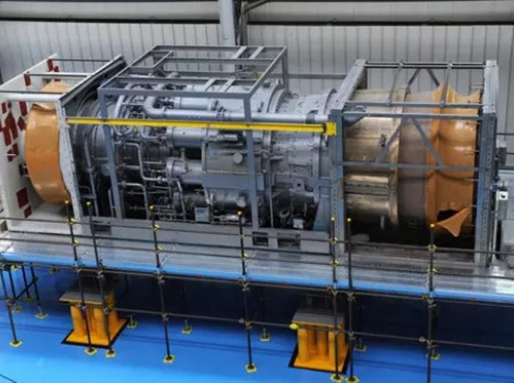 " alt="Baker Hughes Announces Major Gas Technology Orders for Venture Global LNG">
 " alt="Tullow Highlights 2025 Operational Plans in Ghana">
 " alt="TotalEnergies to Supply 1.5 TWh to STMicroelectronics in France Over 15 years">
 " alt="Oil & Gas Crucial for African Growth: AEC Calls for Industry Support to Defend African Market">
