Petroleum Africa
Find us on: 


Friday, July 2, 2010
Sillenger Exploration Corp. and its airborne survey partner, Fugro Airborne Surveys, have conducted a joint-reconnaissance flight of the Rio Muni area of Equatorial Guinea to see the region firsthand, and to get a better sense of the size and scope of the survey. Fugro is scheduled to conduct an airborne geophysical survey over the Rio Muni.
Sillenger said that it expects that all the necessary government permits and procedures will be in place shortly to enable Fugro Airborne Surveys to establish their base of operations at the airport at Bata, in Rio Muni. Fugro personnel currently stationed in Equatorial Guinea are organizing pre-survey strategy, planning, and logistics. The survey aircraft is expected to arrive in Bata by mid-July, and once final equipment configuration is completed, the survey is expected to commence during the third week of July.
The purpose of doing an airborne geophysical survey of this magnitude is to provide the government of Equatorial Guinea and Sillenger with a detailed geological mapping of Rio Muni and a portion of its continental shelf, to enable the country to unlock its vast mineral wealth by developing its mining industry.
This survey will create one of the most current, extensive, and sophisticated geological databases in all of Africa, if not the world. The database will identify the locations and types of likely resource deposits ‒ minerals and metals, diamonds, rare earths, oil and gas, and groundwater, offshore oil and gas, and is a critical element of the CLP (Claims Licensing Program). The CLP will not only provide expedient fast-track regulatory efficiency, but it may provide precise locations of actual drill targets, which may further help reduce some of the costs and risks for the exploration companies, and help to facilitate effective investment decisions.
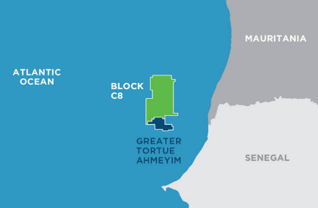 " alt="First LNG Realized at the Greater Tortue Ahmeyim Project">
 " alt="United Energy Acquires Western Desert Producer APEX">
 " alt="Baker Hughes Announces Major Gas Technology Orders for Venture Global LNG">
 " alt="Tullow Highlights 2025 Operational Plans in Ghana">
 " alt="TotalEnergies to Supply 1.5 TWh to STMicroelectronics in France Over 15 years">
 " alt="Oil & Gas Crucial for African Growth: AEC Calls for Industry Support to Defend African Market">
