Petroleum Africa
Find us on: 


Thursday, April 11, 2013
The airborne gravity and magnetic geophysical surveys on CAMAC Energy’s onshore Lamu Basin Blocks L1B and L16 in Kenya has commenced. The data acquisition will cover essentially the entire 12,129 sq km in Block L1B and the entire 3,613 sq km in Block L16, exceeding the gravity and magnetic survey requirements for each block during the initial exploration period under the relevant PSAs.
The results of the airborne gravity and magnetic survey will be used to optimize the placement of 2D seismic lines by identifying faults, basement structures, and intra-sedimentary volcanic layers and/or intrusions. The company expects data acquisition to be completed during April of 2013 and to receive initial results in Q3.
“This is the first step to unlocking the high potential value of our onshore Kenya acreage,” said senior VP of Exploration and Production Segun Omidele. “These gravity and magnetic surveys will satisfy the survey requirements of the first exploration period, and most importantly, will allow us to delineate an optimal 2D seismic program on the Blocks.â€
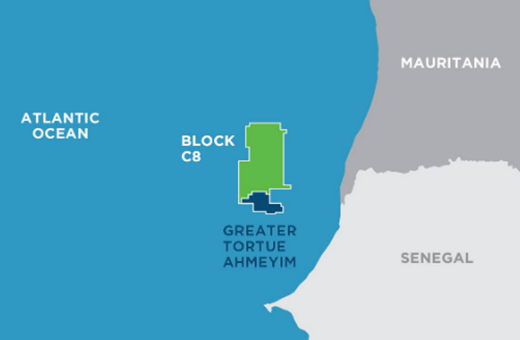 " alt="First LNG Realized at the Greater Tortue Ahmeyim Project">
 " alt="United Energy Acquires Western Desert Producer APEX">
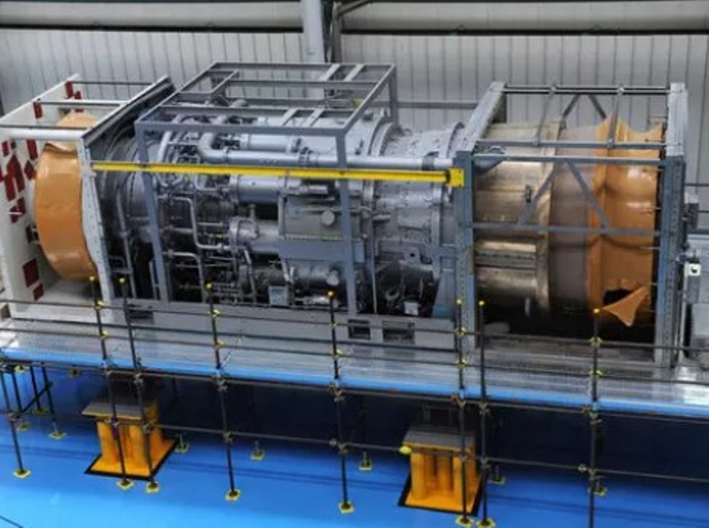 " alt="Baker Hughes Announces Major Gas Technology Orders for Venture Global LNG">
 " alt="Tullow Highlights 2025 Operational Plans in Ghana">
 " alt="TotalEnergies to Supply 1.5 TWh to STMicroelectronics in France Over 15 years">
 " alt="Oil & Gas Crucial for African Growth: AEC Calls for Industry Support to Defend African Market">
